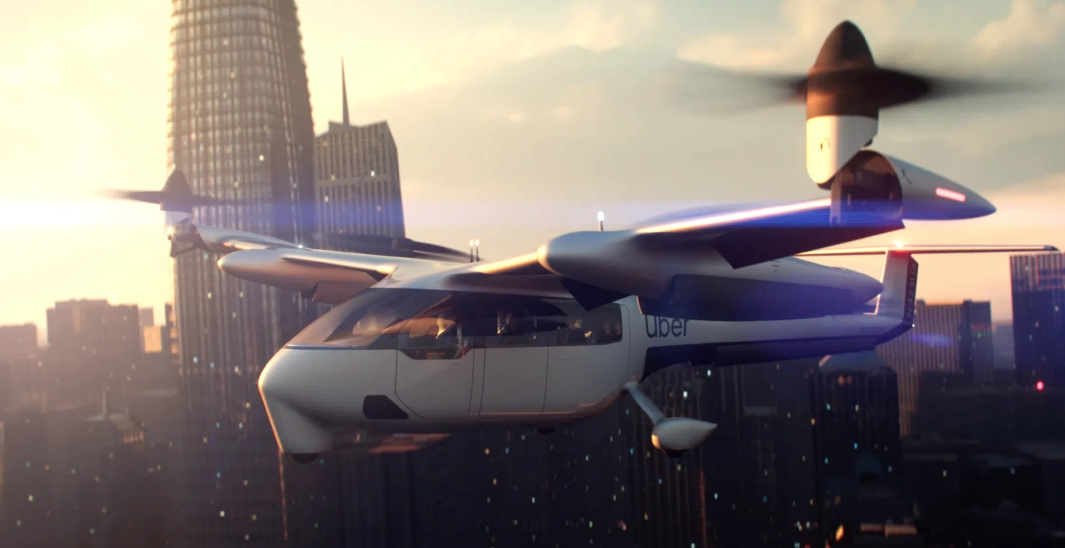
At this week’s Uber Elevate Summit in LA, I saw the power of using StreetLight Data’s transportation analytics for a brand-new mobility challenge: Optimizing the rollout of new infrastructure for aerial urban transport. Uber hosted the conference to “explore the exciting future of urban aviation” (read: flying shuttles). While lots of the press focused on the new models of Electric Vertical Take-Off and Landing Vehicles (eVTOLs), I know readers of this blog will be even more excited by the use of data-driven planning to design their infrastructure!
What is UberFlux and How Did it Use StreetLight InSight?
At the opening address, and again at a deep dive panel, Uber showed off updates to the UberFlux tool. This tool pulls in data from several sources, including StreetLight InSight, our on-demand platform for turning Big Data into transportation analytics. UberFlux is used, among other things, to find optimal solutions to a complex problem: Where are the best places to site “nodes” for Uber’s upcoming UberAIR program? It is a stellar example of putting Big Data to work to drive transportation forward (should I say “fly” transportation forward?).
Jon Petersen, Head of Data Science at Uber Elevate, said: “StreetLight InSight and the StreetLight team play an important part to our modeling efforts and remain wonderful partners for the Elevate team.”
You might ask – why does Uber, a company with so much transportation data, benefit from StreetLight analytics? The answer is that Uber knows about Uber trips. But they don’t know about non-Uber trips. That’s where we come in.
The Uber team used StreetLight InSight to measure the volume and detailed characteristics of trips and travel activity between every block in the LA Metro area – to understand all 45+M daily trips. In the words of Eric Allison, Head of Elevate at Uber, “We’ve taken our own Uber data, which we have a lot of, and combined it with third-party data…and thus we can build a picture of close to 100% of the movement in cities.” StreetLight InSight is a key source of that third party data. You can watch this beautiful animation of total activity and origin and destinations derived from our Metrics by watching Eric’s address on YouTube. In the video embedded here, you can start at around minute 42 and keep watching through minute 57 to see how it all fits together:
Here’s why using third-party data like ours is so important: When planning for long distance aerial transportation, you have to know about long distance trips that currently take place in Ubers, but you also have to know about the trips that take place in private cars and via other modes.
By mixing together both data sources, as well as other information from a detailed adoption survey done by RSG, the team at Uber Elevate was able to create a tool dedicated to creating the most cost-, time-, and energy-efficient strategy to kick off this bold new concept for urban transportation.
From StreetLight’s perspective, this is an excellent example of clients integrating their own data with ours to solve complex problems. It demonstrates the power of data to push transportation infrastructure planning beyond the status quo. We see other partners moving in this direction (though not necessarily with flying cars) and can’t wait to share more examples.
Should We Be Excited or Worried about Flying Shuttles?
The conference brought up several other questions for me in regards to StreetLight’s Data’s broader mission to reduce vehicle miles traveled (VMT) in gas-powered, privately owned cars:
1. I still have outstanding concerns about the greenhouse gas efficiency of electric aerial transport compared to electric vehicle transport. Ride-sharing is key for both and Uber Elevate seems dedicated to shared access, which is good.
2. Uber stated that the availability of this option will probably unlock latent demand for longer distance trips that don’t occur today because the travel times are just too long. This raises a flag to me. I think they’re right because lowering travel costs (in time or dollars) usually does increase VMT. While there is some economic benefit in this, such as linking smaller, co-located cities so they can operate like a megacity. However, we’ve seen historical evidence that opening up new long-distance options (even transit!) may drive up total regional VMT. No matter how efficient the mode may be, we cannot achieve our sustainability and quality of life goals if VMT increases.
3. A lot of people have instinctive concerns about the equity of aerial transportation. I share those concerns. As with the greenhouse gas emissions, sharing is again critical to make this mode as affordable and equitable as possible and I’m glad to see the emphasis of the Elevate program on shared rides. In addition, it’s critical that Elevate achieve its vision for a multimodal transport future that includes transit, bike/scooter/vehicle shares, and other options in a network with aerial transport. Good corporate and public policy and political courage will be required to mitigate negative equity consequences. (Of course, we’ll also need data to measure how the launch of new modes like UberAIR affects everyone else in the system to make such policy.)
4. If you have a chance, listen to the presentation from Uber Elevate about sound psychology by Joseph Schittenlacher! There’s a lot of complexity when it comes to urban aerial transport sound and nuisance. As someone with some serious misophonia, I was intrigued on a personal level. Uber’s goal is to be half as loud as an urban truck. I propose a noise cap-and-trade system. For every eVTOL that Uber (or anyone else) gets licensed to fly, it has to pay for an electric (noiseless) retrofit of two locally owned trucks.